11
Los Alamos, NM Fire
by David LaPlantz ·
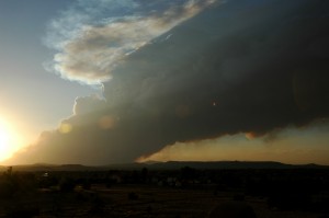
Top Photo: This is what the the Los Alamos fire (looking to the West) looked like last night, in the Jemez Mountain range, around 8:30 PM MDT.
Hot, dry and smoky here in Santa Fe area today.
So far, according to Sante Fe’s only public radio station, KSFR, 30 structures have burned in the fire near Los Alamos, NM. The fire is within 50 feet of the Los Alamos Lab at 1:00 PM MDT. At this time, only voluntary evacuation is in effect.
44,000 acres have burned thus far and according to authorities this blaze might double or triple in size before it is over.
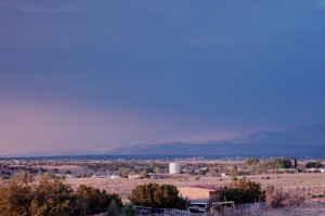
Bottom Photo: This is what the sky looked like over Santa Fe, at the same time as other photo above. The dark area at top of photo is not the sky, but effects from the Los Alamos fire. This view is looking Northeast, at the Sangre de Christo Mountains. Look closely and you will see the Pacheco Fire smoke we’ve been dealing with for over a week at this point!
